
Earth Now
Provided by: NASA|Published on: April 27, 2021|Last updated: July 16, 2026
Grades: 6, 7, 8, 9, 10, 11, 12
Type: Data, Graphs, and Maps
Subjects: Biology, Earth and Space Sciences
Authors: NASA
Location: Earth
This resource has been reviewed by SubjectToClimate's climate scientists and verified for scientific accuracy and up-to-date information. Learn about our review process →
This resource has been reviewed by SubjectToClimate's climate scientists and verified for scientific accuracy and up-to-date information. Learn about our review process →
Synopsis
- This interactive resource from NASA provides satellite imagery and data displayed on a 3-D animated image of the Earth.
- It provides information such as air temperature, carbon dioxide, sea level, soil moisture, water vapor, and ozone.
- Students can select the data and date range they are interested in exploring.
Teaching Materials
Positives
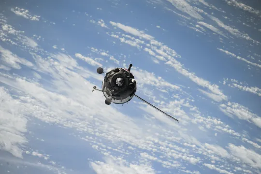
- You can animate the data over the time period selected and the satellites are orbiting the Earth in real time.
- Students can accurately see the continents and oceans without the distortion of 2D maps.
Additional Prerequisites
- Students should be able to read a map.
- A solid internet connection will make the images load faster.
Differentiation
- Cross-curricular connections can be made with geography classes when considering the effects of temperature, sea level, and water vapor on where human populations may be most at risk from climate change.
- Students can select a satellite, research its mission, and present their findings to the class.
- This resource can be used as guidance for student to create their own satellite mission proposal to answer a question they have about the Earth.
- Other similar resources include the CO2 Data Explorer and Paleoclimate.
This resource offers up-to-date global maps of air temperature, carbon dioxide, carbon monoxide, and several other vital signs of the planet. Additionally, it offers real-time locations of satellites in orbit, including the International Space Station. This resource is recommended for teaching.
Teaching Tips
Standards
Resource Type and Format
Scientist Reviewed
This resource has been reviewed by SubjectToClimate's climate scientists and verified for scientific accuracy and up-to-date information. Our review process ensures that every resource in our library reflects the current state of climate science.
Learn about our review process →