Historic Preservation and Climate Change

This resource has been reviewed by SubjectToClimate's climate scientists and verified for scientific accuracy and up-to-date information. Learn about our review process →
Provided by: Rutgers Climate Institute|Published on: April 27, 2021
VideosScientist Reviewed
9101112
Scientist Reviewed This resource has been reviewed by SubjectToClimate's climate scientists and verified for scientific accuracy and up-to-date information. Learn about our review process →
Synopsis
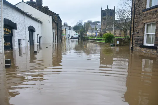
- This video from the Rutgers Climate Institute focuses on the research done by Amanda O'Lear, a graduate student at Rutgers University, which found that almost all of New Jersey's historic sites are at risk of flooding.
- Her research categorizes these sites by flood risk and can be used to prioritize safety measures for the historic sites most at risk.
Subjects: Earth and Space Sciences, History, Engineering
Authors: Rutgers Climate Institute
Region: New Jersey
Languages: English
Teaching Materials
Positives
- This short video shows that young people can make important discoveries and impact their society.
- The video uses graphics, research articles, and interviews to make it engaging and credible.
Prerequisites
- Students should be familiar with academic research and articles.
- Students should have an understanding of climate change and its impacts.
Differentiation & Implementation
- A possible activity is to have students look at the data from the sources that Amanda O'Lear used, and see if they come to the same conclusion.
- This video can be used as a research example, and students could do their own research to see if they can answer similar questions about climate change in their area.
- Some related resources are this video, Health and Medical Lifelines Flood Exposure Analysis, this video, Changing Planet: Rising Sea Level, and this article, How a Changing Climate Is Impacting US River Systems.
This video presents research work done by Amanda O'Lear, a Rutgers University graduate student, on flood risk mapping using archival data from FEMA to determine the impact of flooding on historical infrastructure and the potential risk in the future. The method adopted to re-classify the potential risk to show the most vulnerable sites to prioritize for intervention is suitable. Thus, this resource is insightful and recommended for teaching.
Teaching Tips
Standards
Resource Type and Format
Scientist Reviewed
This resource has been reviewed by SubjectToClimate's climate scientists and verified for scientific accuracy and up-to-date information. Our review process ensures that every resource in our library reflects the current state of climate science.
Learn about our review process →